Quick Answer: Sausalito is the first town north of the Golden Gate Bridge — a hillside village of roughly 7,300 residents on Richardson Bay in southern Marin County, CA (ZIP 94965), incorporated in 1893. Its market runs on two lifestyles that exist almost nowhere else together: stacked hillside homes reached by stairways and lanes with bay and skyline views, and one of America's largest floating-home communities at the Richardson Bay docks. The 94965 ZIP is bigger than the city — it includes unincorporated Marin City and most of the floating-home docks, both under county jurisdiction. There are no Mello-Roos taxes; view corridor, access, parking, and (for floating homes) berth terms are what actually price this market.
Key Takeaways
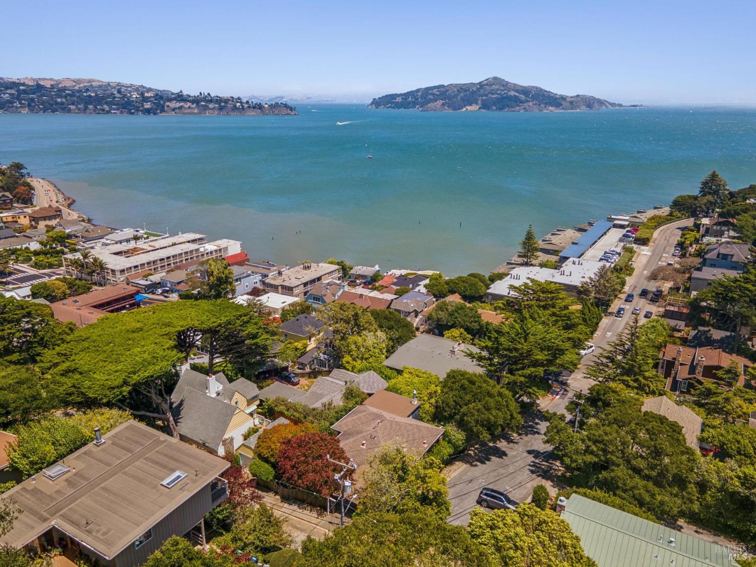
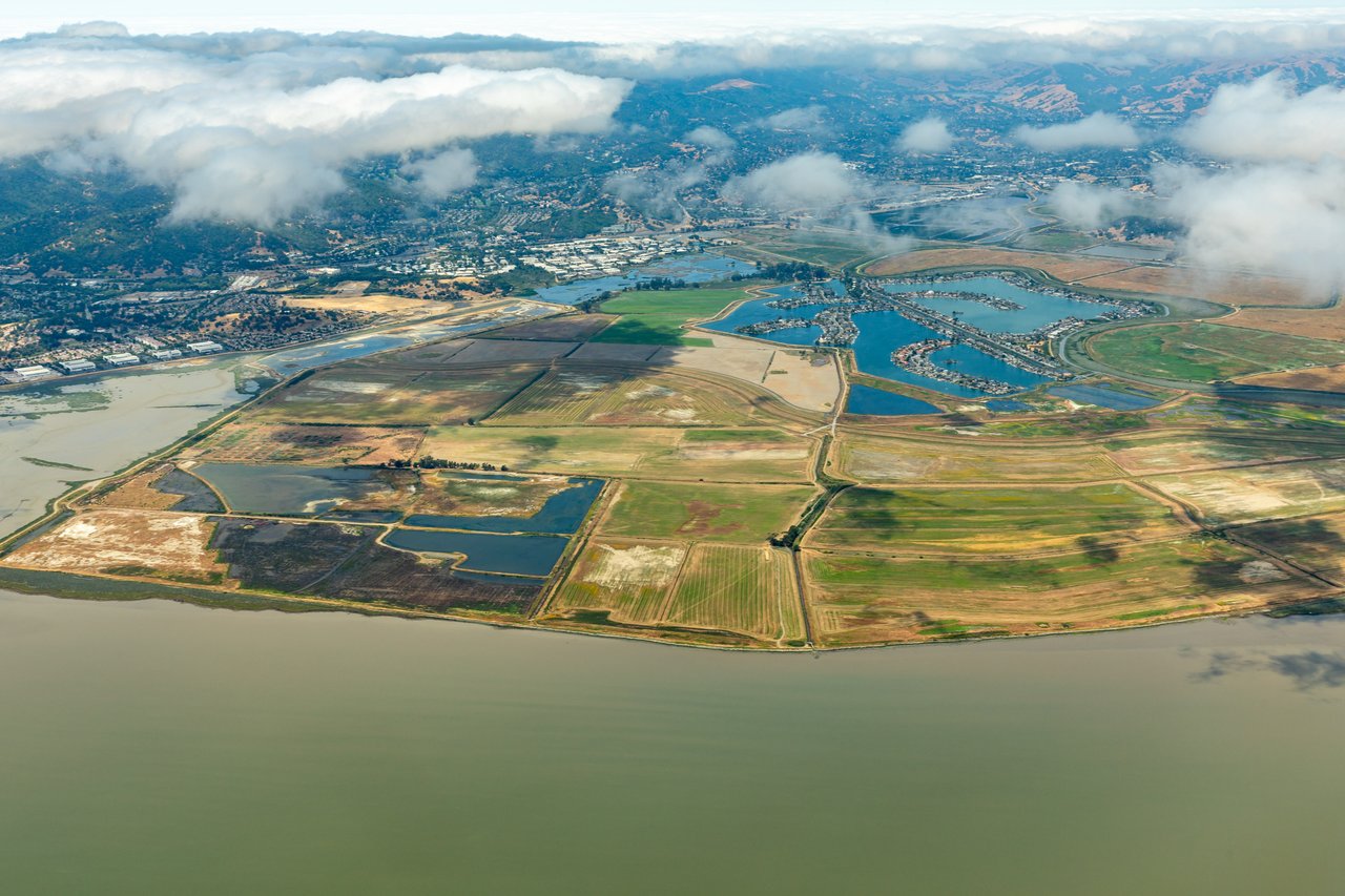
The 94965 ZIP code contains three distinct jurisdictions, and the difference shapes transactions. Incorporated Sausalito is the hillside amphitheater and waterfront most people picture: Old Town's original grid at the south end, downtown along Bridgeway, The Hill above it, and the Marinship's working waterfront to the north. Marin City — an unincorporated Marin County community whose history is rooted in the WWII Marinship shipyard workforce — sits in the valley northwest of town with its own identity and county governance. And most of the famous floating-home docks along Richardson Bay north of the city limits are themselves unincorporated county territory: the town's signature housing type largely carries a Sausalito address without sitting inside the city.
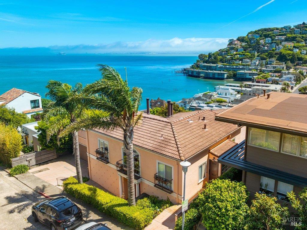
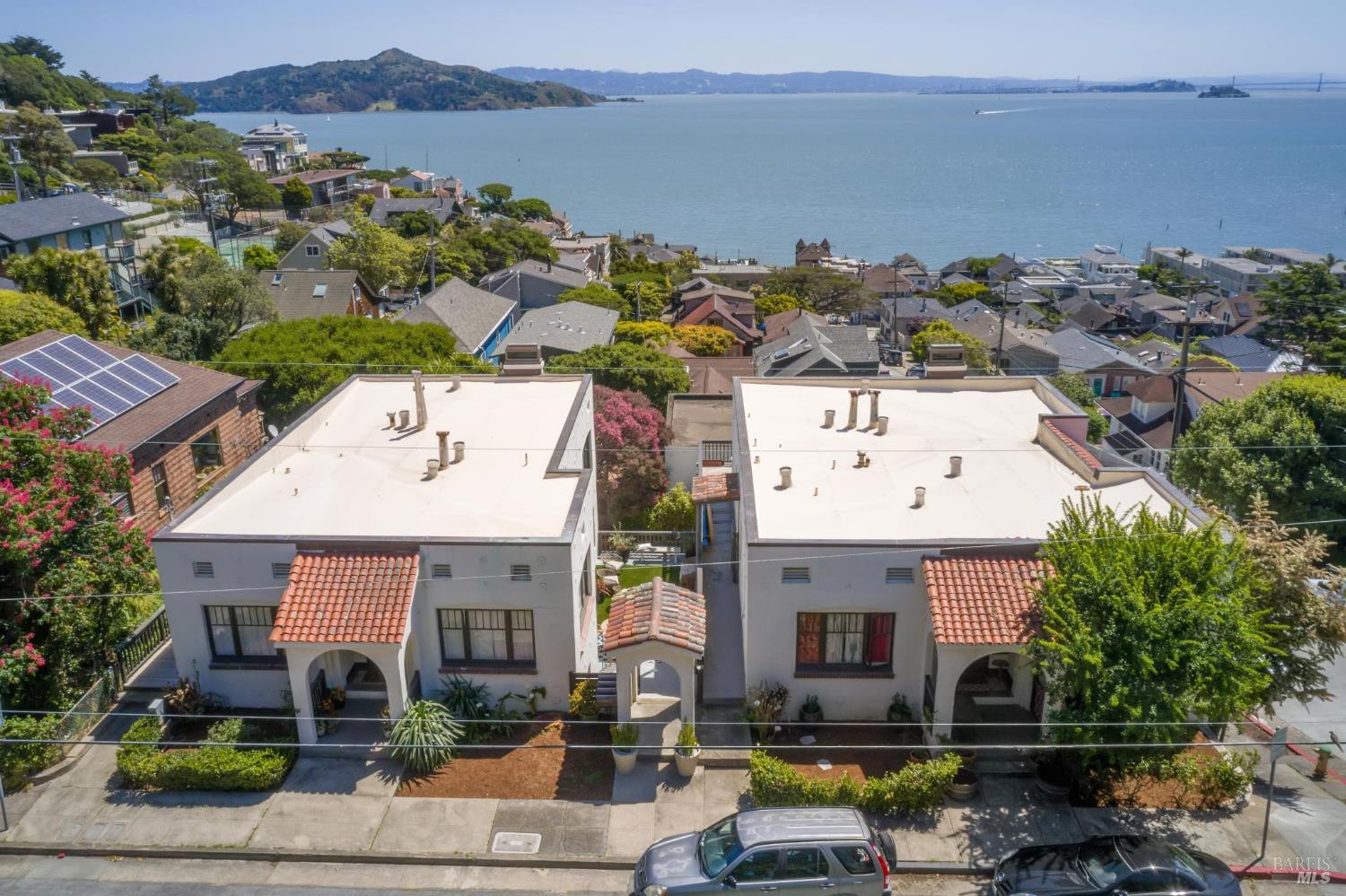
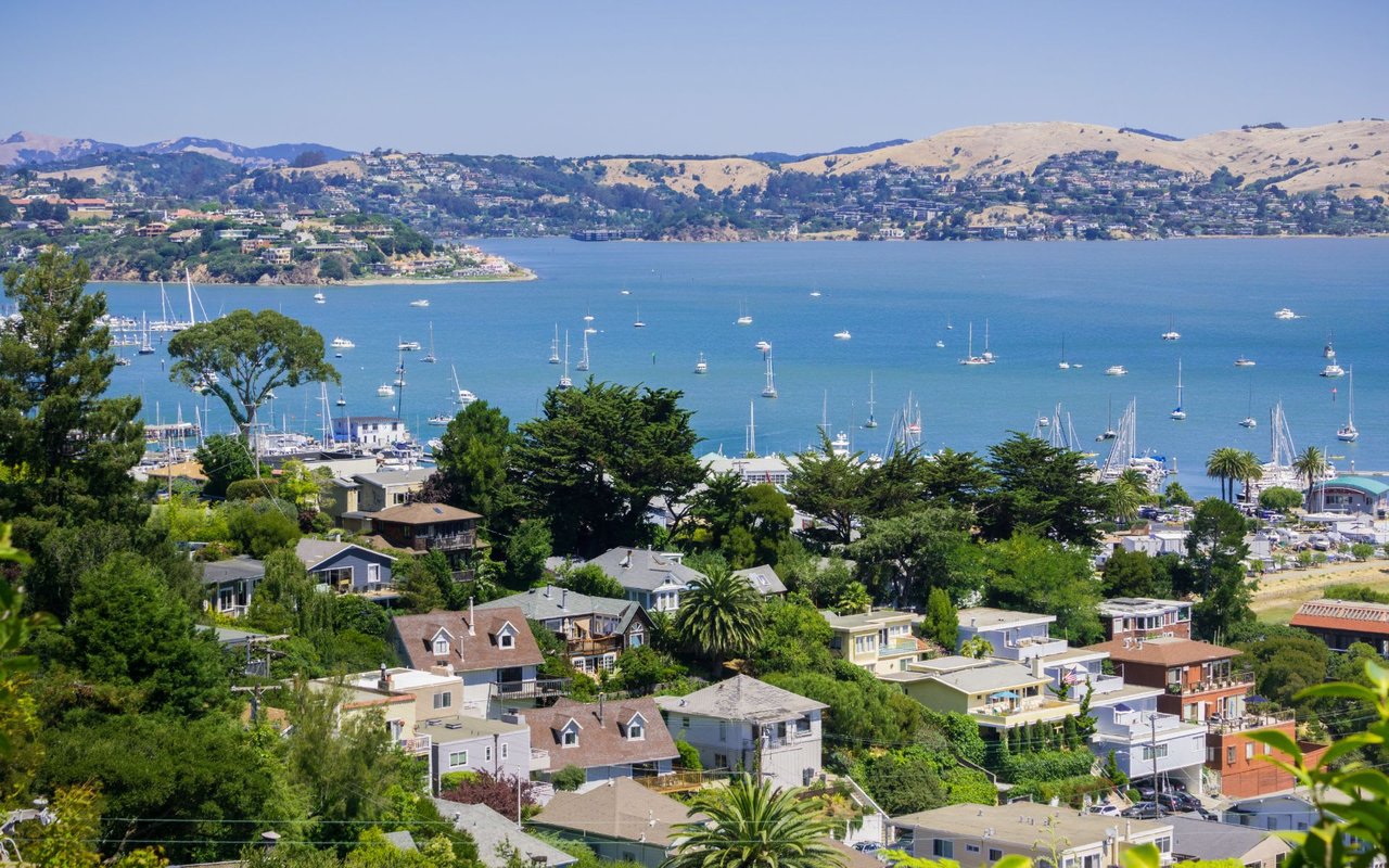
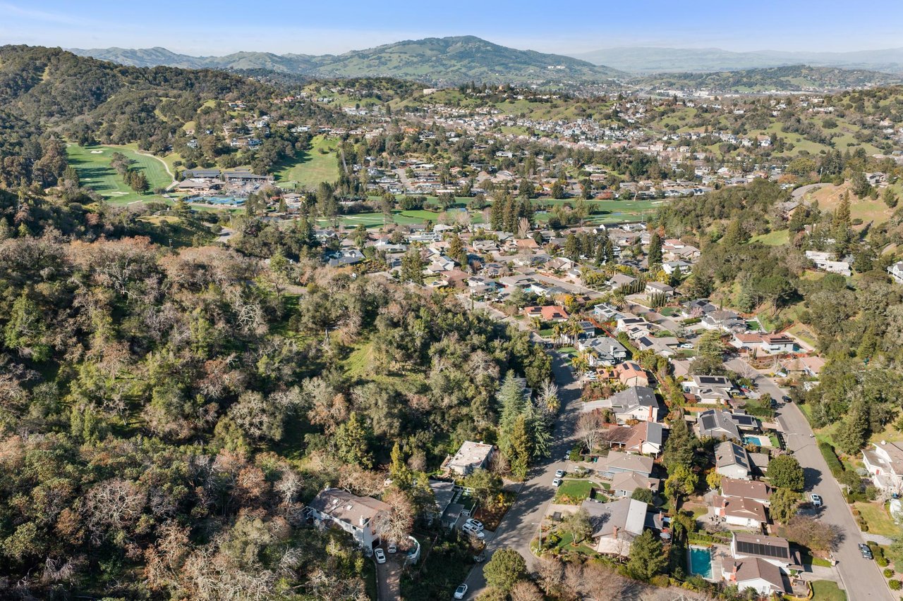
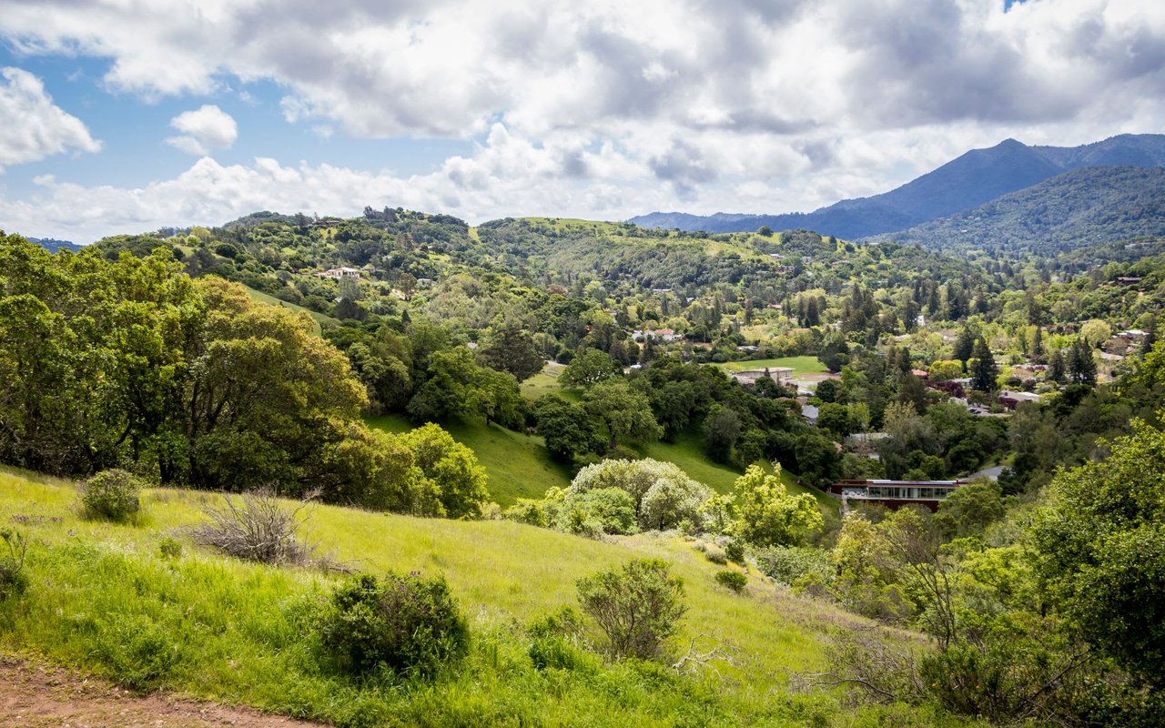
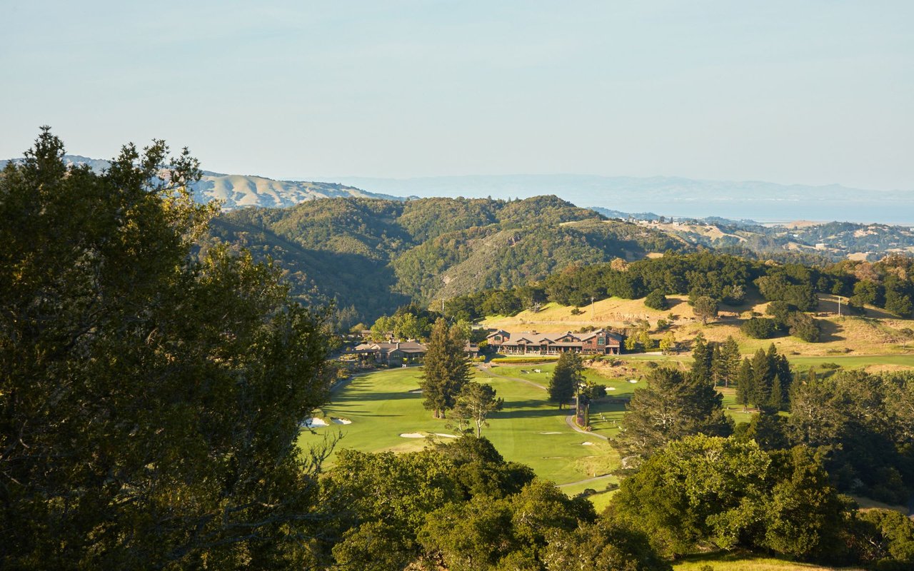
Geographically, Sausalito occupies the steep eastern face of the Marin Headlands where it meets Richardson Bay, with US-101 running along the ridge above and the Golden Gate National Recreation Area wrapping the town's south and west. That federal greenbelt — Fort Baker directly south, the Headlands beyond — is permanent, which is the structural reason Sausalito cannot expand and why its housing stock is effectively a fixed supply.
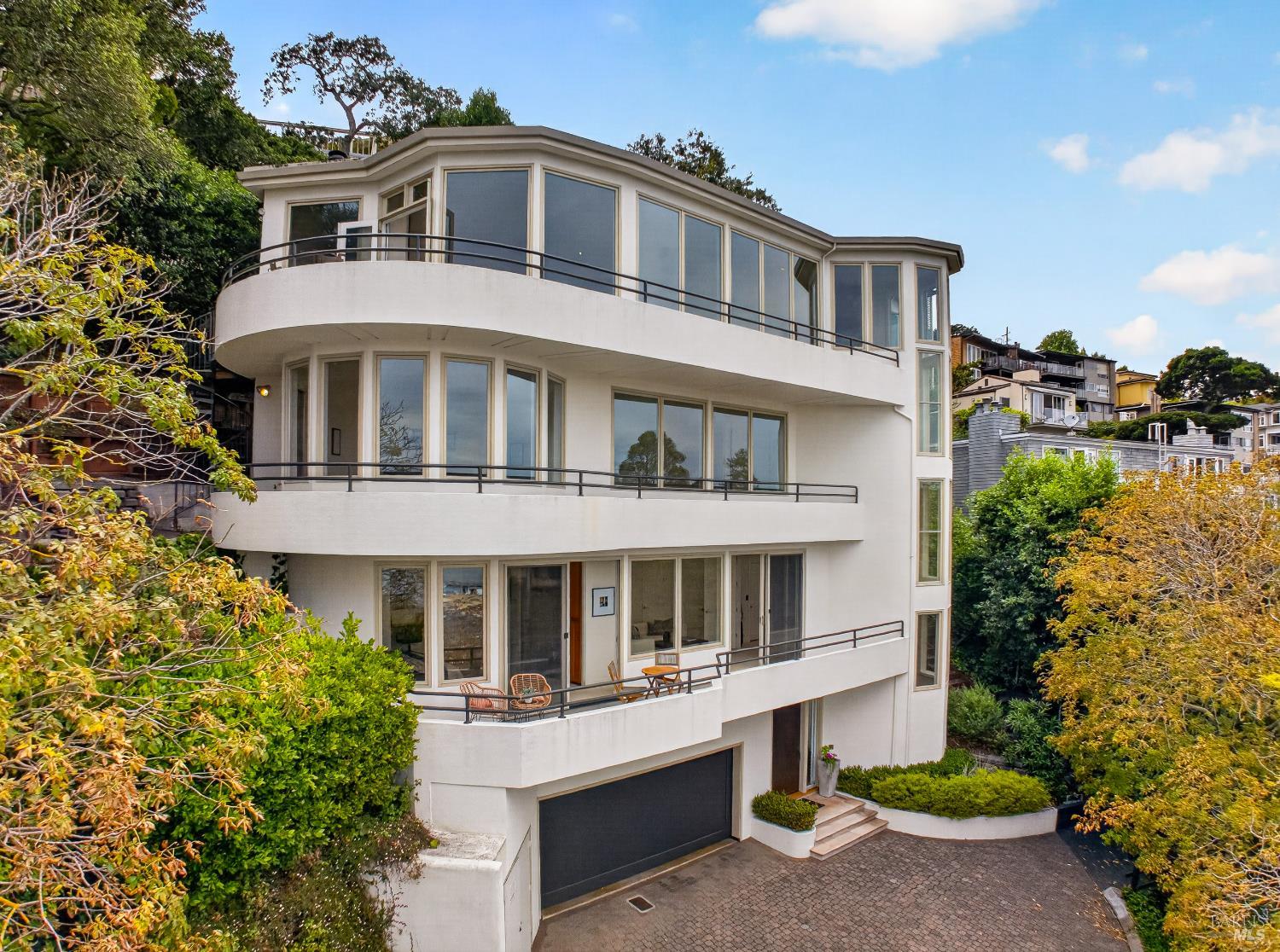
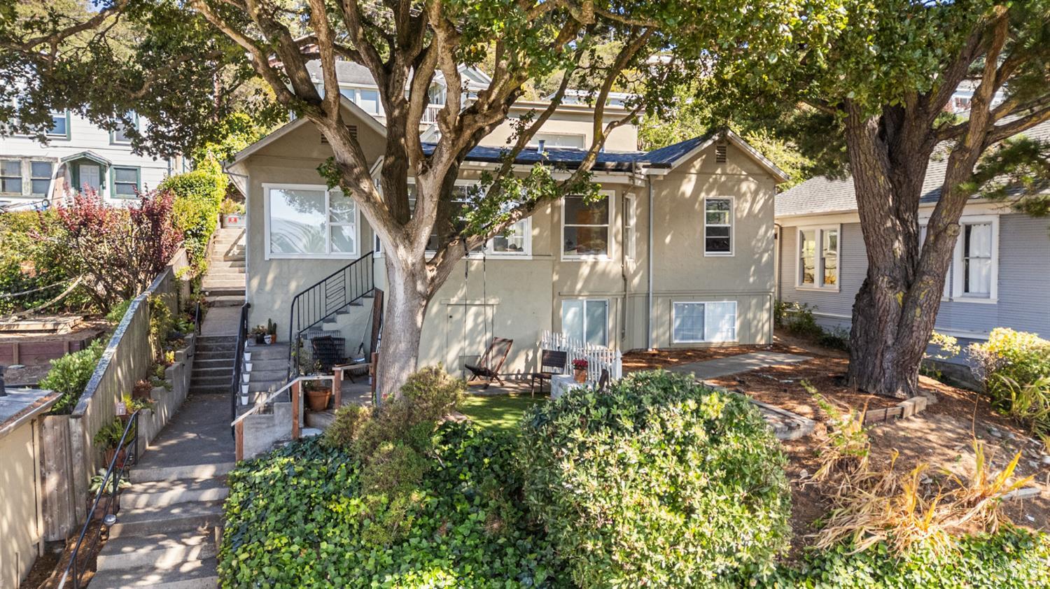
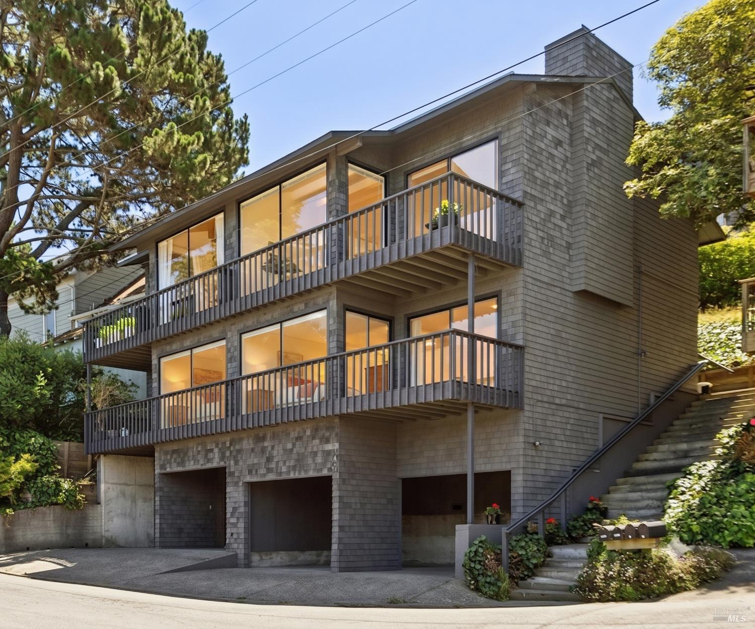
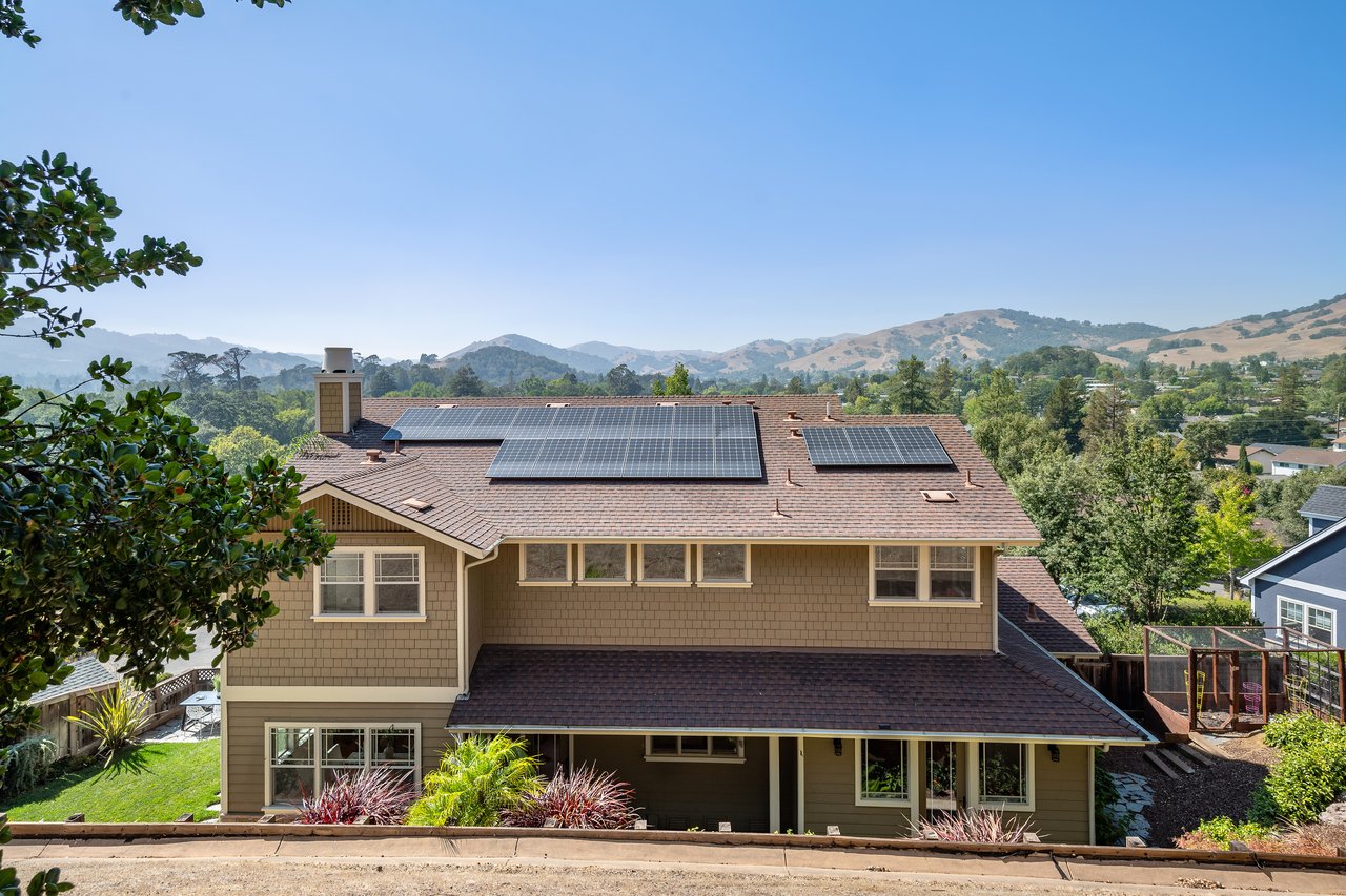
Sausalito is a fixed-supply market selling a location that cannot be reproduced. The town is built out against protected federal land, hillside terrain and town character make new construction rare, and the buyer pool includes everyone — Bay Area and beyond — who wants bay views minutes from San Francisco. In my quarter-by-quarter BAREIS MLS analysis, Sausalito behaves like a collection of micro-markets rather than one town: hillside view homes, step-lane cottages, downtown condos, and floating homes each draw distinct buyer pools and clear at their own pace.
Two durable patterns matter for anyone transacting here. First, the view-and-access hierarchy prices everything: view corridor, light relative to the fog line, and the practical realities of parking and stair access routinely matter more than square footage, which is why two similar homes a block apart can trade very differently. Second, the market bifurcates the way the rest of Marin does, only sharper: prepared, accurately priced homes attract fast competition, while listings that misjudge price or condition sit in full public view. In a town this small, a stale listing becomes its own comp problem.
This guide is deliberately evergreen, so the perishable numbers live where I update them constantly: my Marin Market Intelligence briefings and video library carry the current quarter's BAREIS MLS data for Sausalito, and you can browse current listings at any time.
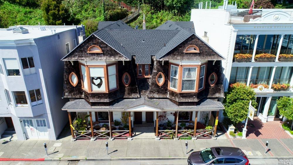
Sausalito's eight recognized neighborhoods feel like eight different towns, and choosing among them is mostly a decision about terrain, tourist proximity, and which of the town's two lifestyles you're buying:
Sausalito reveals itself best from Alexander Avenue down — the full loop below takes about 15 minutes without stops. Do it twice: once midday on a sunny Saturday to see the tourist and parking reality honestly, and once on a weekday evening to see the town residents actually live in.
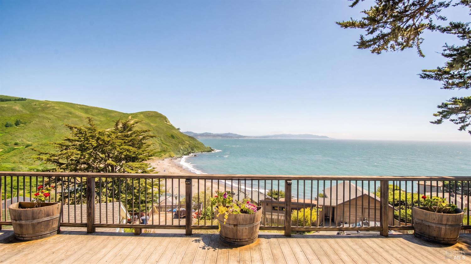
Stop 1 — The Alexander Avenue descent. Take the first exit north of the Golden Gate Bridge and let Alexander Avenue wind you down toward the water. The turnoff for Fort Baker appears early — worth a detour for Cavallo Point and the under-the-bridge vantage — and the descent itself previews the town's whole proposition: federal parkland on one side, bay panorama on the other, and not a strip mall in sight.
Stop 2 — Old Town and Hurricane Gulch. As Alexander feeds toward the south end of town, explore the blocks around Second and Main — Sausalito's original grid and some of its oldest homes. If it's afternoon, stop and stand outside for two minutes in Hurricane Gulch; the name is the disclosure. Wind exposure here is parcel-specific and absolutely worth testing before an offer.
Stop 3 — Bridgeway through downtown. Roll the waterfront past Plaza Viña del Mar's elephant statues — 1915 Panama-Pacific Exposition survivors — and the ferry landing. This is where you run the parking test: circle once and note what's actually available. If a home you're considering is within three blocks of here, this experience is part of its price, for better and worse.
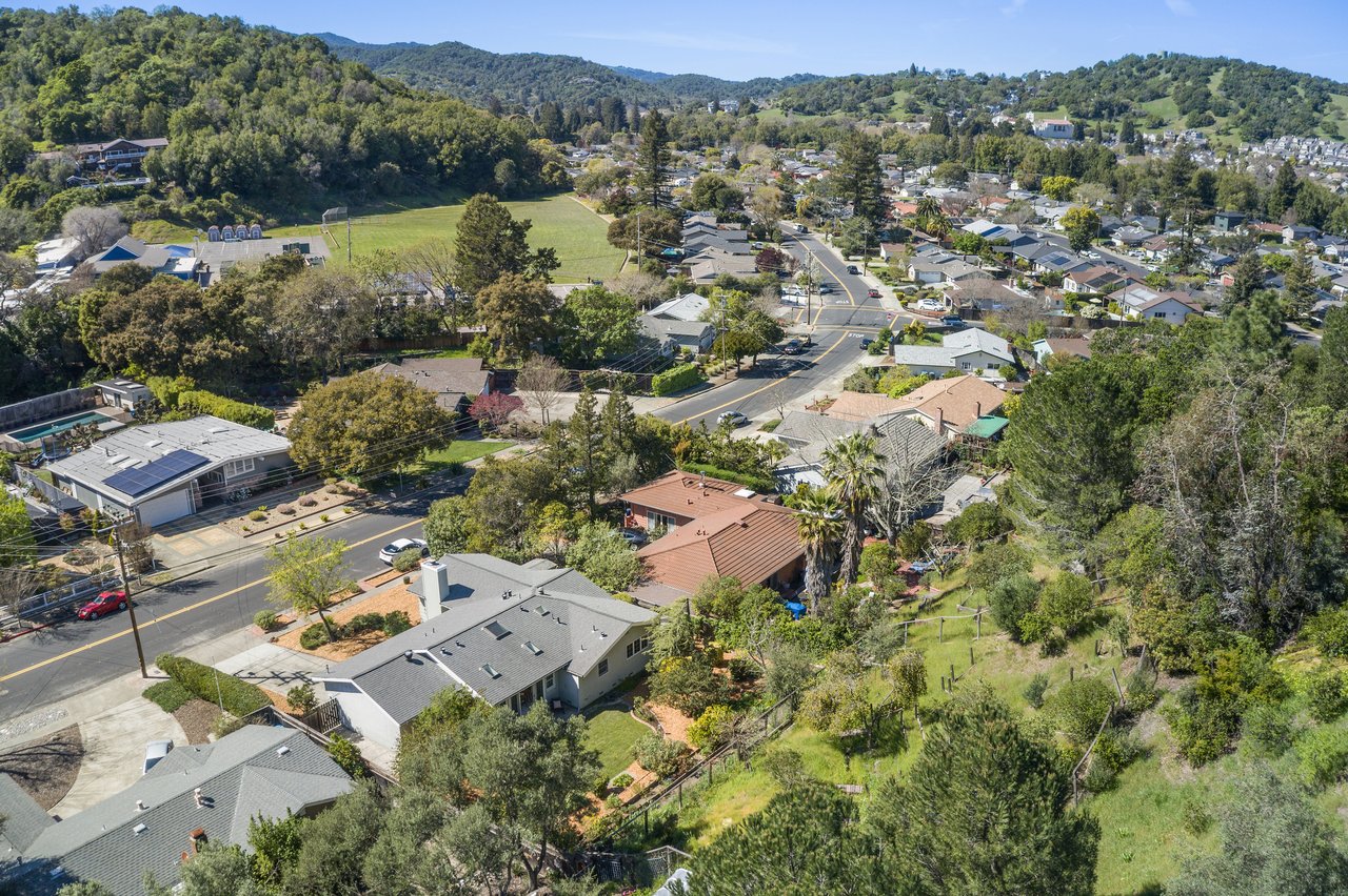
Stop 4 — Princess Street up to Bulkley Avenue. Turn uphill and climb to the Bulkley corridor, The Hill's classic view street. Park where legal and walk a stretch of one of the pedestrian lanes; note the homes reached only by stairs. Count the steps to any candidate's door and picture groceries, contractors, and a couch making that trip — the step-lane lifestyle is one of Sausalito's genuine charms and one of its most mispriced diligence items. This elevation is also your fog-line check: on a gray summer day, the sun often starts somewhere on this slope.
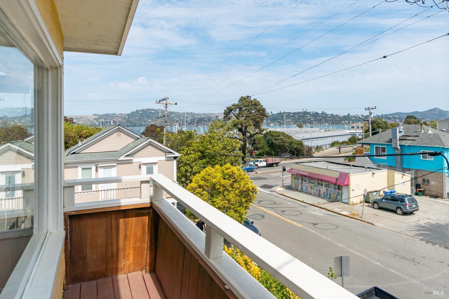
Stop 5 — Caledonia Street. Descend and jog one block inland to Caledonia — the residents' commercial strip. This is the errand loop you'd actually live: markets, coffee, the everyday town that Bridgeway's visitors mostly never see. Buyers who tour only the waterfront routinely misjudge what daily life here is like.
Stop 6 — The Marinship and the floating-home docks. Continue north on Bridgeway into the Marinship: the Bay Model Visitor Center, the ICB artist studios, and the working waterfront that keeps Sausalito a real maritime town. Then continue to the Gate 5 and Gate 6 Road docks and walk a public dock respectfully — these are people's front porches. Notice the range, from modest to architecturally serious, and remember you've crossed into unincorporated county jurisdiction without leaving the 94965.
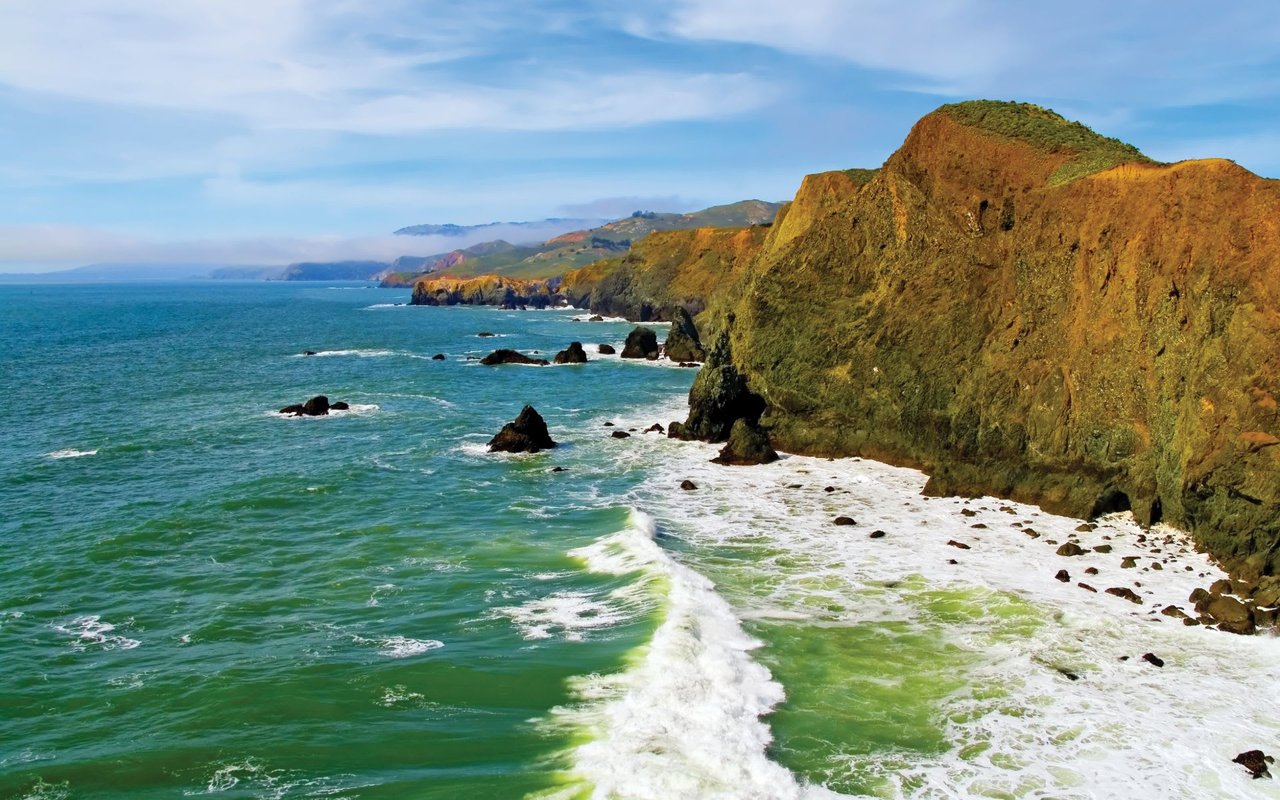
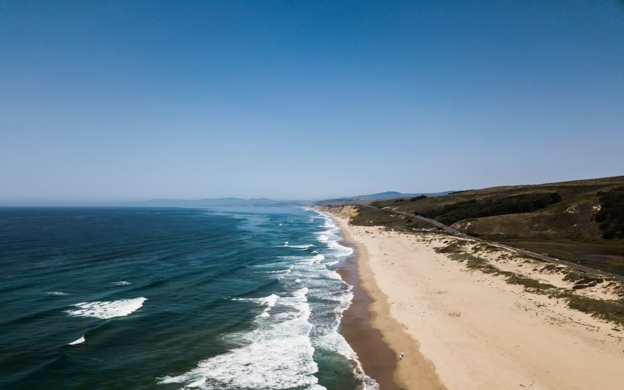
Optional extensions. Take Spencer Avenue up to Wolfback Ridge Road for the ridge-parcel tier and, on the right day, the view down onto the fog deck. Or continue past Fort Baker into the Marin Headlands to Rodeo Beach — the backyard that explains why this town never gets bigger. Prefer the guided version? My town profile video is embedded below, and the full tour collection lives on my channel @KyleFrazier and in the Imagine Marin video library.
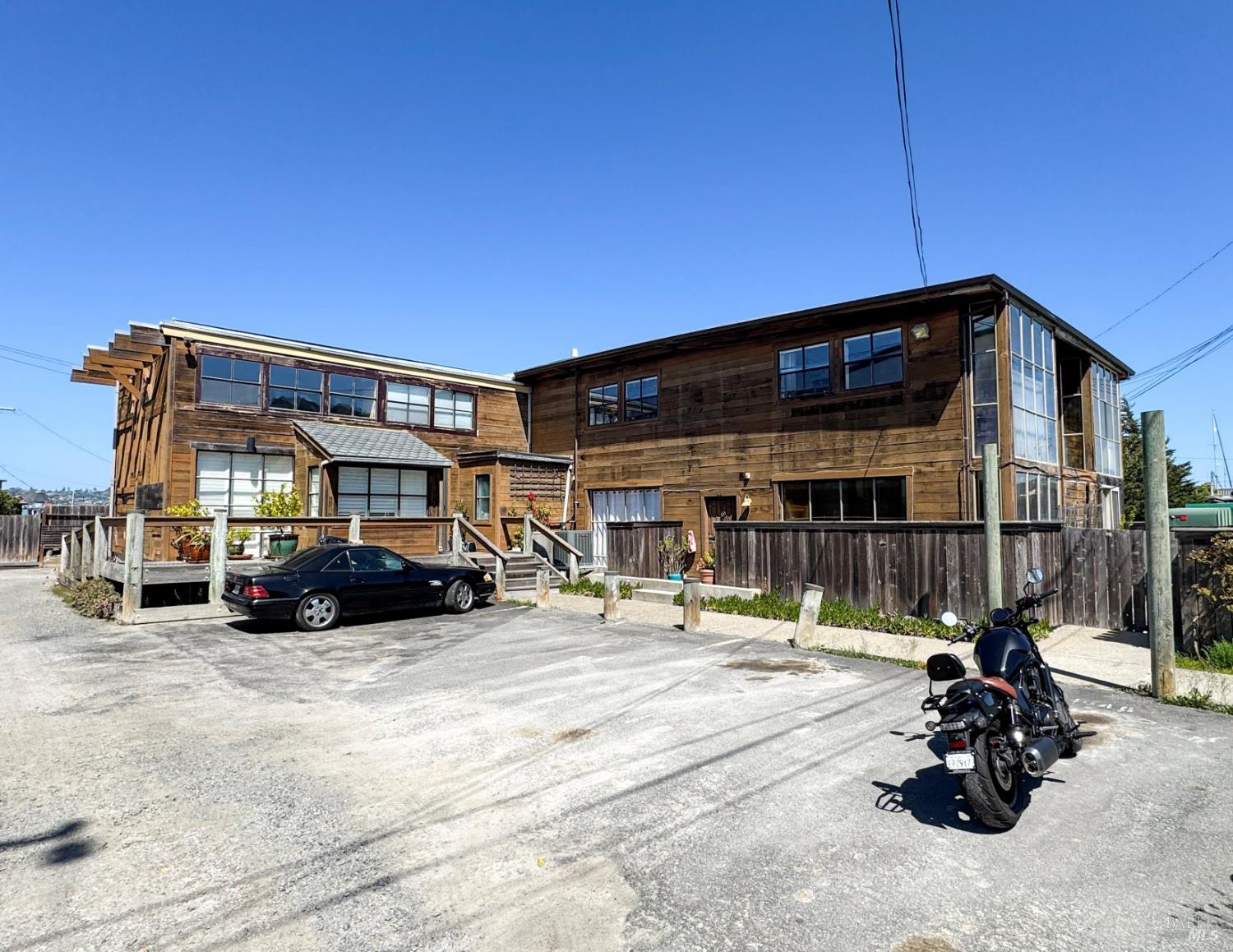
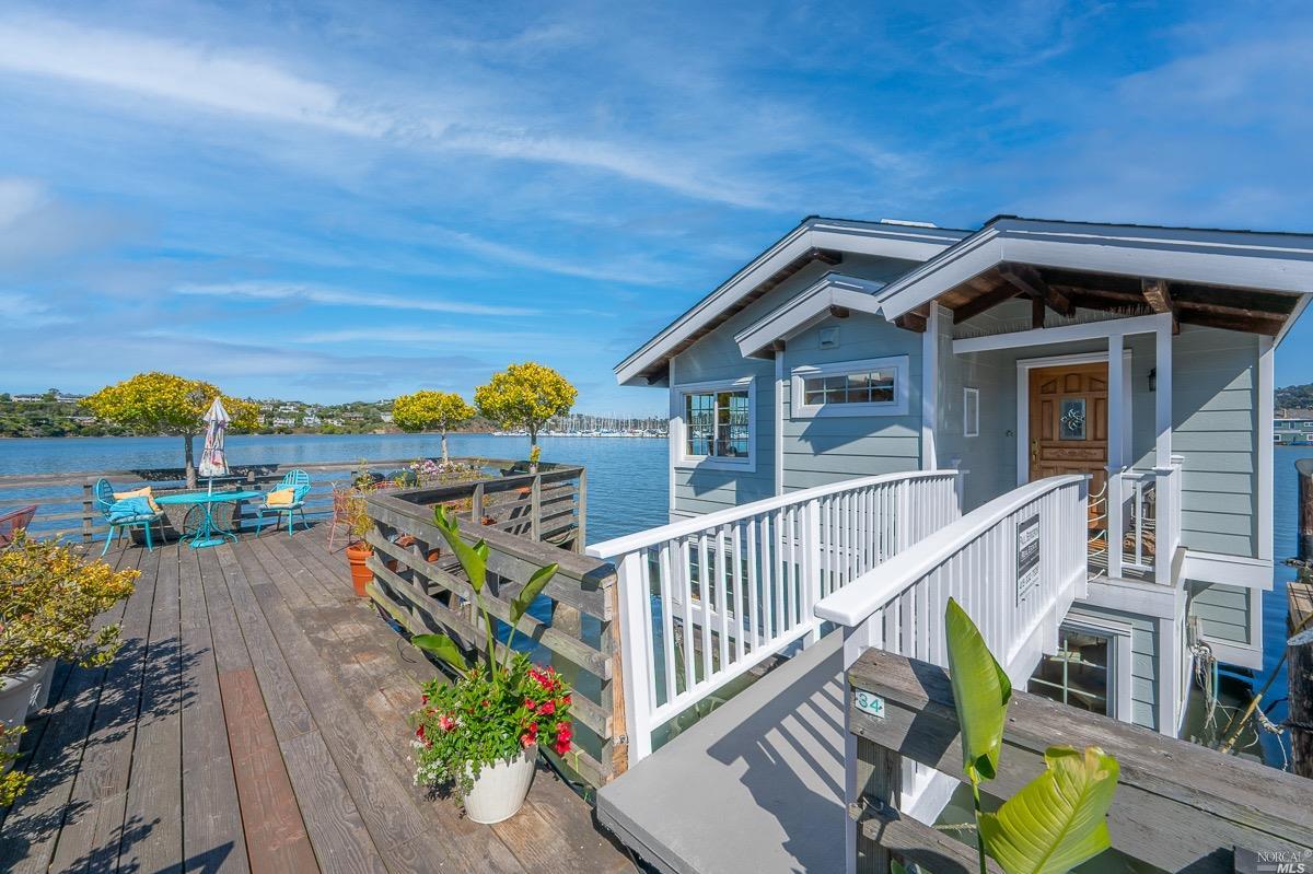
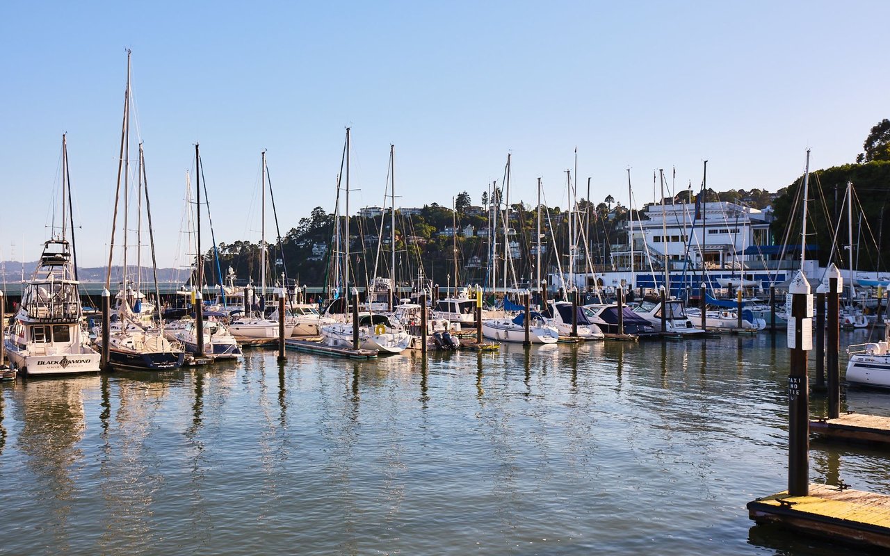
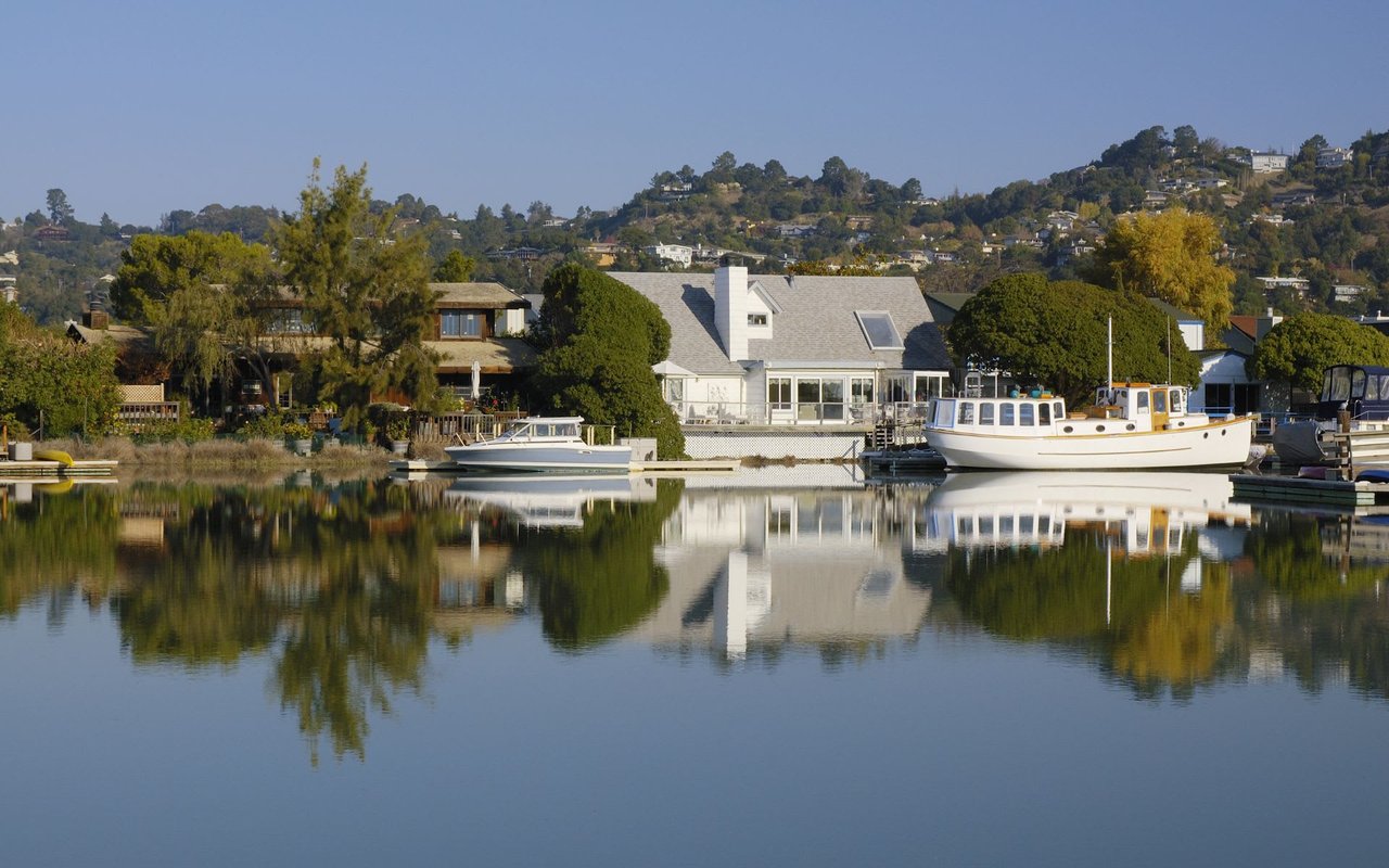
Sausalito's floating-home community — several hundred homes at the Richardson Bay docks, including Waldo Point Harbor, Kappas Marina, and Yellow Ferry Harbor — is a legitimate housing market with its own mechanics, not a curiosity. You purchase the home itself and take over a berth, typically via license or lease, with monthly berth fees covering the slip and shared dock infrastructure. The homes connect to municipal sewer, water, and power, and dock associations govern the shared elements. Financing runs through specialty lenders on different terms than a standard mortgage, and cash is common.
The diligence stack is specific and learnable: the berth agreement's terms, transferability, and fee history; the dock association's rules and finances; a professional hull and flotation survey (treat it as the foundation inspection); and insurance availability confirmed before contingencies come off. Priced per square foot, floating homes can be a relative value against the hillside — and the range runs from modest studios to multimillion-dollar architectural pieces. The heritage is real too: Otis Redding wrote "(Sittin' On) The Dock of the Bay" on a Sausalito houseboat in 1967, and the creative colony that song came from is the direct ancestor of today's community.
Daily life splits between two Sausalitos that coexist a block apart. The visitor's town runs along Bridgeway: the ferry landing, Plaza Viña del Mar, galleries, and a restaurant row that includes institutions like Sushi Ran, Poggio, Scoma's on the water, Fish. at the harbor, and Bar Bocce's bayfront patio. The residents' town runs one block inland on Caledonia Street and up the lanes: the market run, the coffee line, the town that empties of tourists by evening. Buyers should tour both, because they're buying both.
The outdoor ledger is enormous for a town this size: the Marin Headlands and Rodeo Beach over the hill, Fort Baker and Cavallo Point at the bridge, the Bay Model and the Marinship's working docks, Sea Trek's kayak launches on Richardson Bay, and the bike path north toward Mill Valley. The town's creative spine survives in the ICB artist studios and the floating-home docks — Sausalito remains one of the few Bay Area towns where the bohemian history is still a living neighborhood rather than a plaque.
The Sausalito Marin City School District serves grades K-8 for both Sausalito and Marin City. For grades 9-12, the town belongs to the Tamalpais Union High School District, with most students attending Tamalpais High School in Mill Valley. For performance data, consult GreatSchools and the California School Dashboard directly, and verify current attendance assignments for any specific address — boundaries and programs can change.
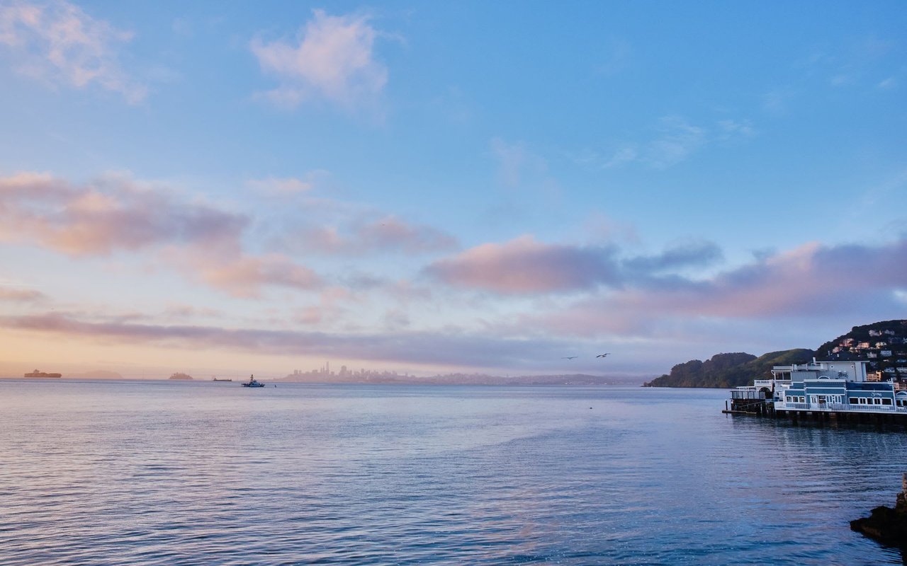
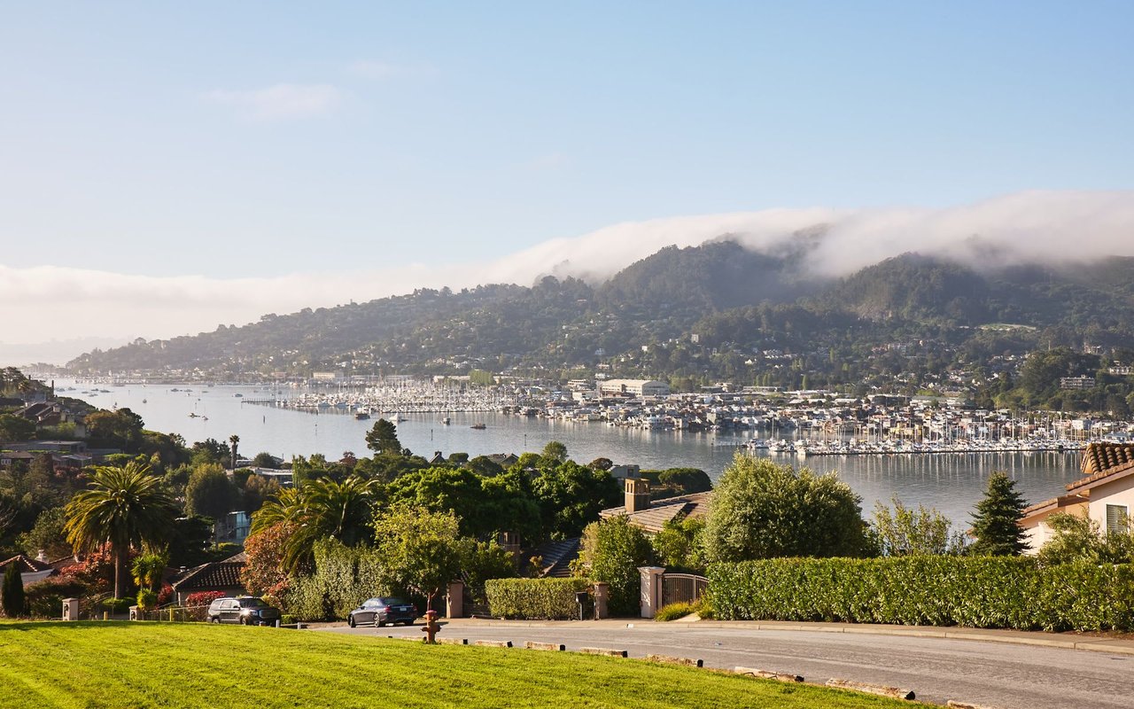
Sausalito offers the shortest Marin commute in both modes. By car, plan on roughly 15 to 25 minutes to downtown San Francisco in normal conditions — the town's exits are the first north of the bridge — with peak-hour and event traffic through the Robin Williams Tunnel as the honest variable. By water, the ferry runs from the downtown landing to the San Francisco Ferry Building in about half an hour, and it is a genuine commute option residents structure their days around, not a tourist amenity. Homes within an easy walk of the landing price that in. Golden Gate Transit buses serve the 101 corridor from the Spencer Avenue pads. Test your actual route at your actual hour before you commit.
Sausalito's cost stack is clean at the structural level and property-specific everywhere else. There are no Mello-Roos Community Facilities Districts, and most single-family homes carry no HOA — the exceptions are condominium buildings and the floating-home dock associations, where berth fees and association dues are the carrying-cost core. Beyond the roughly one percent base property tax, Marin County tax bills include voter-approved parcel taxes: school measures, the Marin Wildfire Prevention Authority (Measure C) tax, and local levies. I pull the actual tax bill for any parcel a client is serious about.
The hillside works on structures year-round: retaining walls, drainage, foundations on grade, and seismic questions on the steepest lots belong in every inspection scope. Step-lane access adds its own economics — construction and moving bids run higher when everything travels by hand, and parking is a separate line item worth verifying at multiple times of day. Ask early whether the local sanitary district's sewer-lateral requirements apply at transfer.
Shoreline parcels can sit in mapped FEMA flood zones — king tides periodically reach low-lying Bridgeway and the Marinship — and financed purchases in mapped zones typically require flood insurance. Floating homes swap that exposure for the marine stack: berth terms, dock association health, hull condition, and specialty insurance. Different diligence, same principle — confirm it before contingencies come off.
Sausalito's wildfire exposure concentrates where the town meets open space: the upslope edges toward the Headlands and the Wolfback Ridge area carry elevated Fire Hazard Severity Zone designations, while the waterfront flats generally do not. The Southern Marin Fire Protection District serves the town, the Marin Wildfire Prevention Authority funds county-wide vegetation management and evacuation planning, and California's AB 38 defensible-space documentation applies to sales in designated zones. Verify any address through the CAL FIRE viewer, and get a written insurance quote — not a verbal indication — early in escrow. I make that sequence standard on every hillside purchase I represent here.
These are southern Marin's three water-defined towns, and buyers shopping one almost always tour the others. I maintain full guides to Mill Valley and Tiburon as well.
Sausalito | Mill Valley | Tiburon | |
|---|---|---|---|
Setting & character | Hillside village stacked above a working waterfront; the county's most visited downtown | Canyon-and-flats town at the base of Mount Tamalpais with a theater-and-trails downtown | Peninsula town with a ferry-anchored downtown and ridge-to-shore range |
Signature housing | Step-lane hillside homes, view cottages, and the floating-home docks | Canyon homes under redwoods, downtown cottages, hillside view properties | Ridge view estates, mid-century flats, downtown condos, Paradise Cay dock homes |
Commute anchor | First exits off the bridge; ~30-minute ferry from downtown | US-101 via Tam Junction; Sausalito ferry ~10 minutes away | Commuter ferry from downtown; CA-131 to US-101 |
Climate position | Fog line's edge — waterfront gray, upper elevations often above the deck; Hurricane Gulch wind | Canyons hold fog and shade; flats clear earlier | Sun-belt side of the fog line; afternoon westerlies by exposure |
Fire/flood profile | WUI at the Headlands edges; king-tide reach on low Bridgeway/Marinship | Extensive canyon WUI; flood pockets near Richardson Bay | Grassland-ridge WUI edges; marine diligence on the waterfront |
HOA / Mello-Roos | No Mello-Roos; HOAs in condos and dock associations | No Mello-Roos; HOAs only in condo/townhome communities | No Mello-Roos; HOAs in condo stock, some PUDs, Paradise Cay |
Relative price position | Below Tiburon on average, overlapping at the view line; floating homes add a distinct band | Top tier of Marin | Top tier of Marin |
No — Sausalito is the first town north of the Golden Gate Bridge in Marin County, incorporated in 1893. The confusion is understandable: it is the closest Marin address to the city, roughly 15 to 25 minutes by car or about half an hour by ferry to the San Francisco Ferry Building. That proximity, combined with a hillside-village setting that reads more Mediterranean than suburban, is the foundation of Sausalito's real estate market.
More than the city. The 94965 ZIP covers incorporated Sausalito plus two areas under Marin County jurisdiction: Marin City, the unincorporated community with roots in the WWII Marinship workforce, and most of the famous floating-home docks along Richardson Bay north of the city limits. Jurisdiction determines planning rules, service districts, and process, so confirming city versus county status is a day-one step for any 94965 purchase.
You purchase the home itself and take over a berth — typically a license or lease at one of the Richardson Bay docks such as Waldo Point Harbor, Kappas Marina, or Yellow Ferry Harbor — with monthly berth fees covering the slip and shared dock infrastructure. The homes connect to municipal sewer, water, and power. Core diligence: berth agreement terms and transferability, current fee levels and history, dock association rules and finances, and a professional hull and flotation survey.
Yes, but through specialty lenders rather than conventional mortgage channels — floating homes are titled differently than real property, and financing typically involves fewer lender options, larger down payments, and sometimes shorter terms than a standard home loan. Cash purchases are common. Budget for the hull survey the way you would a foundation inspection, and confirm insurance availability before removing contingencies. I connect clients with lenders who actually work this market.
Scarcity stacked on location. The town is built out against protected federal land, hillside terrain caps construction, new building is nearly nonexistent, and the buyer pool includes everyone who wants bay views minutes from San Francisco. Pricing is driven as much by view corridor, light, and access as by square footage — two similar homes a block apart can trade very differently. For current BAREIS MLS numbers, see my Marin Market Intelligence briefings.
A meaningful share of Sausalito's hillside homes are reached partly or entirely by pedestrian steps and lanes rather than a driveway. That shapes daily life and costs: moving and construction bids run higher (everything travels by hand or hoist), some insurers ask access questions, and parking becomes a separate line item. These homes also include some of the most charming properties in town. Walk the full access route, uphill, before you write an offer.
Near the waterfront on summer weekends, yes — Bridgeway absorbs heavy tourist traffic, and many older hillside homes have limited or no off-street parking. The practical test: visit the property midday on a sunny Saturday and again on a weekday evening, and see what parking actually looks like. Homes with deeded parking or a real garage carry a durable premium here for exactly this reason.
Ferry service runs from the downtown landing to the San Francisco Ferry Building in roughly half an hour on the water — one of the Bay Area's most scenic commutes and a genuine daily-life amenity rather than a novelty. Homes within an easy walk of the landing price that convenience in. Summer afternoons add tourist volume returning bikes to the city, so regular commuters learn the schedule rhythms quickly.
Roughly 15 to 25 minutes to downtown San Francisco in normal conditions — Sausalito's exits are the first ones north of the Golden Gate Bridge. Peak hours and event traffic can stretch that meaningfully, and the southbound bridge approach through the Robin Williams Tunnel is the variable to test. If you'll commute daily, drive your actual route at your actual hour a few times before committing to a home.
The Sausalito Marin City School District serves grades K-8 for both Sausalito and Marin City, and the Tamalpais Union High School District serves grades 9-12, with most students attending Tamalpais High School in Mill Valley. For performance data, consult GreatSchools and the California School Dashboard directly, and verify current attendance assignments for any specific address rather than assuming.
No Mello-Roos — Sausalito has no Community Facilities Districts. Most single-family homes carry no HOA; the exceptions are condominium buildings and the floating-home docks, where dock associations govern shared infrastructure alongside berth fees. Standard Marin County parcel taxes apply, including school measures and the Marin Wildfire Prevention Authority (Measure C) tax. I pull the actual tax bill for any parcel a client is serious about.
The hillside and ridge edges bordering open space — including the slopes toward the Marin Headlands and Wolfback Ridge — carry elevated Fire Hazard Severity Zone designations, while the waterfront flats generally do not. The Southern Marin Fire Protection District serves the town, and California's AB 38 defensible-space documentation applies to sales in designated zones. Verify any address in the CAL FIRE viewer and get a written insurance quote early in escrow.
King tides periodically reach low-lying stretches of Bridgeway and the Marinship area, and shoreline parcels can sit in mapped FEMA flood zones requiring insurance on financed purchases. The floating homes, by design, simply ride the tide — one of the quiet advantages of that market. Check the FEMA map for any specific parcel and ask about king-tide history; two properties a block apart can have different answers.
Sausalito sits at the fog line's edge, and elevation is the whole story. Summer marine fog regularly holds the waterfront cool and gray into midday, while homes higher on The Hill or Wolfback Ridge can sit in sun above the fog deck. Hurricane Gulch, at the south end, earned its name from afternoon wind funneling off the headlands. Visit any serious candidate at different hours — the microclimates here are real and they are priced in.
Yes — Otis Redding wrote "(Sittin' On) The Dock of the Bay" in 1967 while staying on a houseboat in Sausalito, watching the ferries cross Richardson Bay. It is the town's bohemian era in one song: the postwar decades when artists, writers, and musicians made the waterfront and its houseboats a creative colony. That heritage survives in the Marinship's ICB artist studios and the floating-home community that grew from those roots.
I would argue the answer is the agent who pairs county-wide data with street-level knowledge of Sausalito's micro-markets — hillside, step-lane, waterfront, and floating home alike. I am Kyle Frazier, JD, CRS, CLHMS, a Broker Associate with Compass (DRE #01405738) and a Marin County broker for more than 20 years. I analyze BAREIS MLS data quarter by quarter across every Marin sub-market, publish that analysis on my YouTube channel and Marin Market Intelligence page, and have been quoted on this market by the Wall Street Journal, Financial Times, and San Francisco Chronicle.
My town profile video walks Sausalito's hillside, waterfront, and docks on camera:
You can also watch it on YouTube, subscribe to my channel @KyleFrazier — over 20,000 local subscribers and one million views — or browse every Marin town tour in the Imagine Marin video library.
I'm Kyle Frazier — JD, CRS, CLHMS, Broker Associate at Compass, and a Marin County broker for more than 20 years, quoted on this market by the Wall Street Journal, Financial Times, and San Francisco Chronicle. Sausalito rewards micro-market precision — hillside, step-lane, waterfront, and floating home each trade differently, and I work them with quarterly BAREIS MLS analysis plus access to off-market and pre-market opportunities that never reach the portals. For buyers, my clients obtain full underwriting up front so their offers compete like cash. For owners, start with a data-driven valuation second opinion.
Book a consultation · Call or text (415) 350-9440 · [email protected] · Explore more Marin neighborhood guides.
 Novato, CA Real Estate: A Resident Broker's Neighborhood Guide
 Pointe Marin, Novato CA (94949): Current Listings & Complete Neighborhood Guide
 Marin Country Club Estates (Country Club) Novato 94949 Guide
 Hamilton Field, Novato (94949): The Definitive 2026 Resident & Buyer Guide
 Bel Marin Keys, Novato (94949): Complete Waterfront Community Guide
 Loma Verde, Novato (94949): Complete Neighborhood Guide
 Tiburon, CA Real Estate: A Marin Luxury Broker's Complete Town Guide
 Stinson Beach, CA Real Estate: A Marin Broker's Complete Guide
Sausalito, CA Real Estate: A Marin Broker's Complete Town Guide
Stinson Beach, CA Real Estate: A Marin Broker's Complete Guide
Sausalito, CA Real Estate: A Marin Broker's Complete Town Guide
 San Anselmo, CA Real Estate: A Marin Broker's Complete Town Guide
 Ross, CA Real Estate: A Marin Broker's Complete Town Guide
 Mill Valley, CA Real Estate: A Marin Broker's Complete Town Guide
 Larkspur, CA Real Estate & Complete Town Guide
 Inverness, CA Real Estate: A Marin Broker's Complete Guide
 Greenbrae, CA Real Estate: A Marin Broker's Complete Guide
 Fairfax, CA Real Estate: A Marin Broker's Complete Town Guide
 Corte Madera, CA Real Estate: A Marin Broker's Complete Town Guide
 San Rafael, CA Real Estate: A Marin Broker's Complete Town Guide
 Kentfield, CA Real Estate: A Marin Broker's Complete Guide
 Belvedere, CA Real Estate: A Marin Broker's Complete City Guide
 Nicasio, CA Real Estate: A Marin Broker's Complete Valley Guide